By Per Peterson
Saturated soil. Nearly-full watersheds. Intense, long-lasting storms. It all factors into troubling times if you live in areas like Lake Sarah, Lake Shetek, Slayton or Currie.
“Our soils are all saturated,” said Jim Sehl, a hydrologist for the Department of Natural Resources. “We’re getting to the time of the year where our crops are going to be able to take up a lot of moisture out of the ground, but if we keep getting rains like we have where we get this train of one storm after another, after another all night long with high duration and intense rainfall — that’s where you’re going to see flooding.”
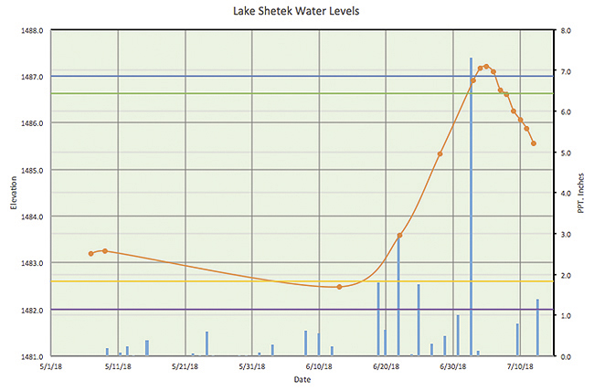
According to the DNR, Lake Shetek was at 1,487.21 feet above sea level last Friday — that’s 0.4 feet above the previous record set on April 10, 1969 (1,486.87). Since then, the lake level has gone down to 1,485.11 (as of Sunday, July 15).
Sehl said everything starts at the Current Lake outlet.
When water levels there get high enough, the result is a strong and steady back flow into Lake Yankton in Balaton. But that’s just the start of it in southern Lyon County and northern Murray County.
Sehl said the watershed-to-lake ratio plays a major role in determining how severe flooding can get.
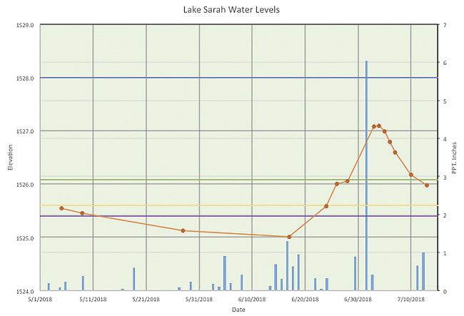
Lake Sarah, for example, has a watershed-to-lake ratio of 10.5-to-1 — every acre of lake (1,200) equals 10.5 acres of upland that drains toward it.
For more on this article, see this week’s Headlight-Herald.

