
By Seth Schmidt
2018 was one of the wettest years ever recorded for the region.
The 49.27” of precipitation logged in Tracy last year is roughly double the 24” historic average for the Tracy area, and may be an all-time modern-day record. This year’s nearly 50” precipitation total dwarfs the 36.73” of precipitation that Tracy received in 1993, a year that was so wet, some farmers weren’t able to plant corn that spring.
The soggy 2018 wasn’t unique to Tracy.
The Southwest Outreach and Research Center near Lamberton recorded 38.29” of precipitation for 2018, a 42% increase from the station’s 27.05” historic average over six decades. The National Weather Service in Sioux Falls reported that the 2018 precipitation totals of 43.49” in Worthington and 39.19” in Sioux Falls were both records.
Both heavy snow and rain contributed to Tracy’s 2018 precipitation.
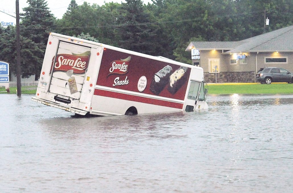
A 25-inch snow total recorded at the Tracy water plant from an April 14-15 storm, earned the city statewide notice. Wet conditions continued into June, with 7.73 inches of rain falling in the Tracy area. With soils already saturated, a July 3 storm system brought torrential rains and more flooding to the area. Tracy received 5.6 inches, although unofficial reports of 6 to 7 inches were not uncommon. A Lake Shetek observer recorded 8.61 inches of rain for July 3.
The early July deluge caused widespread flooding of roads and farm fields and swamped untold basements with drainage water and sewage.
The flooding was so extensive, the first weekend of Walnut Grove’s Wilder Pageant was canceled and Currie’s Fourth of July celebration was delayed.
For more on this article, see this week’s Headlight-Herald.
